Follow us
facebook
instagram
x
youtube
tiktok
pinterest
threads
Latest News
Australia Joins Philippines, Canada in Sea Drills
August 24, 2025
First Pakistani Foreign Minister Visit to Bangladesh Since 2011
August 24, 2025
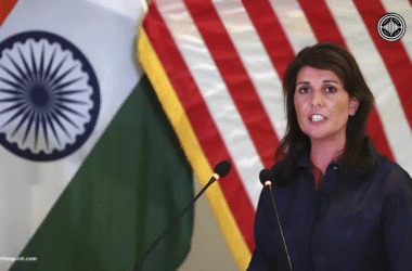
Nikki Haley Urges Stronger U.S.-India Ties
August 24, 2025
Transparent. Unbiased. Yours.
Toggle sidebar & navigation
Home
Breaking News
Economics
Politics & Government
Crime
General News
More
Human Rights
Defence & Security
Crypto
Finance
Real Estate
Home
Breaking News
Economics
Politics & Government
Crime
General News
More
Human Rights
Defence & Security
Crypto
Finance
Real Estate
Breaking News
Australia Joins Philippines, Canada in Sea Drills
August 24, 2025
First Pakistani Foreign Minister Visit to Bangladesh Since 2011
August 24, 2025
Nikki Haley Urges Stronger U.S.-India Ties
August 24, 2025
Trump Targets Chicago With Federal Crackdown
August 24, 2025
American Airlines Flight Diverted After Device Fire
August 24, 2025
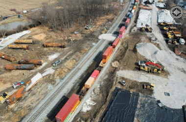
U.S. Freight Railroads Hesitate to Join Safety Program After Ohio Derailment
August 24, 2025
Trump Administration Halts Near-Complete Offshore Wind Project in U.S.
August 24, 2025
U.S. Moves to Deport Salvadoran Man to Uganda After Refusal of Plea Deal
August 24, 2025
UK State Pensioners Risk Losing Up to £294 Over 47-Year Contribution Rule
August 24, 2025
Russia, Germany, Mexico, France, UK, Japan, Brazil, and Spain Unite for CMITE 2025 in Nassau
August 24, 2025